Table of Contents
Here’s What Actually Determines Whether the Site Works
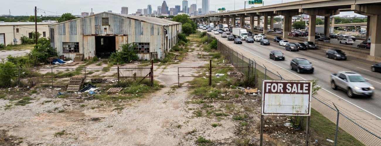
A developer stood on a fifteen-acre parcel off a Fort Worth frontage road and watched eighteen-wheelers stream past at sixty miles an hour, close enough to feel the draft. The land had highway frontage on two sides, a price per acre that felt like a bargain, and a broker’s pitch that wrote itself: visibility, access, done. Fourteen months and one denied driveway permit later, the site still had no legal way for a truck to leave it.
That story repeats itself across Tarrant County more often than anyone in the industry likes to admit. Highway frontage looks like the whole story. It is usually the first chapter of a much longer one, and the chapters that follow, TxDOT approvals, interchange spacing, frontage-road engineering, zoning classification, drainage, and utility capacity, are the ones that decide whether a project gets built on schedule or gets stuck in entitlement purgatory.
Fort Worth’s industrial market has no shortage of highway-adjacent land. What it has a shortage of is highway-adjacent land with a legally reliable, engineering-sound, politically survivable path from the building to the interstate. This is the difference that separates a project that leases up on time from one that burns eighteen months and a construction loan’s worth of carrying costs discovering it the hard way.
Why Highway Frontage Is Not the Same Thing as Highway Access
Industrial development near major highways in Fort Worth benefits from genuinely strong regional connectivity, but frontage on I-35W, I-20, or I-820 tells you almost nothing about whether trucks can actually get on and off the site. The variables that matter are frontage-road configuration, TxDOT access-control lines, interchange spacing, driveway permitting, and the often-overlooked cost of building the turn lanes, signals, and off-site improvements required to connect a parcel to an actual highway entrance.
The strongest corridors in the metro, I-35W and Alliance, I-20 and South Fort Worth, I-30 and East Fort Worth, I-820, U.S. 287, SH 114 and FM 156, and select stretches of SH 121, SH 183, and SH 199, are also among the most competitive industrial submarkets in North Texas. For a generic Class A speculative box, frontage alone rarely differentiates a project anymore. What differentiates it is a superior access profile, a specialized tenant type, an infill position competitors can’t replicate, a cost basis low enough to absorb a longer lease-up, or a public-infrastructure strategy that unlocks something the parcel down the road cannot offer.
Start With the Tenant, Not the Land
Every highway-industrial project that goes sideways shares a common origin story: the site was selected before the use was defined. A parcel with excellent highway visibility might be an ideal fit for a contractor yard, a service center, or a retail-industrial hybrid, and a poor fit for a large distribution facility whose trucks would have to cut through residential streets before reaching the interchange.
Before land is optioned or acquired, the development team should have firm answers on building size and clear height, dock count and trailer parking, daily truck volume, whether the operation involves heavy-haul or oversized loads, hazardous materials, outdoor storage, rail access, power draw, water and sewer demand, and whether the project will be build-to-suit, speculative, or phased. Direct highway access and nearby highway access are not interchangeable assumptions, and confusing the two is one of the most expensive mistakes in the business.
How the Fort Worth Entitlement Process Actually Unfolds
Every highway-adjacent industrial project in Fort Worth moves through a sequence that looks straightforward on paper and rarely is in practice. Understanding where the friction lives, and starting the right conversations early, is what separates a fourteen-month approval from a five-month one.
Corridor and Jurisdictional Screening
The first phase confirms which jurisdiction actually governs the parcel: city limits, extraterritorial jurisdiction, county, or an adjacent municipality with its own rules. It also means pulling existing zoning, future land-use designations, planned-development overlays, airport and rail constraints, floodplain data, and any existing development agreements, TIFs, PIDs, or MUDs attached to the property.
TxDOT’s active and planned project list for the Fort Worth district touches nearly every major corridor in play, I-20, I-30, I-35W, I-820, SH 114, SH 121, SH 183, SH 199, FM 156, FM 1187, U.S. 287, and the Southeast Connector. A highway project already underway or scheduled can shift driveway locations, frontage-road access, right-of-way lines, construction timing, drainage, and the very value of a parcel’s highway frontage. Pulling current TxDOT schematics before finalizing a site plan or a land contract is not optional diligence. It is the diligence.
Zoning and Use Classification
Fort Worth’s industrial zoning framework separates uses into three primary tiers. Light Industrial districts accommodate lower-impact warehouse, flex, assembly, and service-industrial uses. Medium Industrial districts allow more intensive manufacturing, warehouse, and distribution operations. Heavy Industrial districts are reserved for higher-impact processes, outdoor operations, and uses carrying greater emissions, materials, or nuisance potential.
The word “industrial” hides a surprising amount of regulatory nuance. A warehouse, a freight terminal, a trucking facility, a cold-storage building, a fleet-maintenance yard, and a concrete or asphalt operation may all sit under different classifications with different standards, and only City Council can approve a rezoning after public hearings before the Zoning Commission. If the site sits near residential districts, industrial-buffer, landscaping, and building-orientation requirements typically apply as well.
The Pre-Development Conference and Concept Plan
This is where a project’s real risk profile starts to surface. The pre-development conference should address zoning and use classification, whether rezoning or a planned-development district is required, highway and frontage-road access, TxDOT permitting, traffic study scope, truck routing, right-of-way dedication, drainage and floodplain conditions, and fire-flow and emergency-access requirements. A preliminary concept plan, showing the building, docks, truck courts, trailer parking, driveways, and future phases, should accompany the application.
Rezoning or Planned Development
Rezoning becomes necessary when the site is currently agricultural or residential, when existing commercial zoning doesn’t permit the intended use, when the proposed intensity exceeds the district’s allowances, or when outdoor storage and truck operations require a different classification altogether. A site-specific planned-development district can offer custom truck-yard standards, alternative setbacks, and phasing flexibility, but that flexibility comes at the cost of a more negotiated, more politically visible approval process. Developers who underestimate the timeline on a PD rezoning tend to overestimate their construction start date by several months.
Platting and the Question of Legal Access
Highway-adjacent parcels routinely carry unusual access conditions: shared frontage-road driveways, cross-access requirements, access routed through an adjacent parcel, TxDOT-controlled driveways, or frontage roads that are still under construction. A parcel without an independent, legally documented, and engineering-sound path to a public street can be worth meaningfully less than its highway visibility suggests, regardless of what the listing photos imply. This is precisely the kind of structural risk that a permit expediting and entitlement consulting partner is built to catch before it becomes a closing problem, because by the time a title company or a lender’s counsel flags an access gap, the site has often already been under contract for months.
TxDOT Review and the Traffic Study
A project near a state highway may require a driveway permit, an access-management review, a frontage-road permit, right-of-way and utility permits, a traffic-control plan during construction, and coordination with any planned reconstruction already scheduled for the corridor. The project team should confirm driveway spacing, median openings, right-in and right-out restrictions, turn-lane warrants, sight distance, and truck-turning movements well before the site plan is finalized. A new driveway directly onto a highway frontage road is almost always harder to secure than access through a local collector street. The best site is not the one with the most frontage. It is the one with the most reliable and legally controllable truck path.
Fort Worth’s site-plan standards formally weigh the adequacy of access roads, driveways, parking, drainage, and utilities alongside nuisance-prevention measures covering odor, dust, noise, and vibration, which means the traffic and access analysis is not a courtesy step. It is baked into the approval criteria itself.
Site Plan, Civil Engineering, and Highway-Facing Design
Truck courts and trailer yards frequently consume more site area than the building itself, which is why the site plan should be tested against actual tractor-trailer and emergency-vehicle turning templates rather than passenger-car assumptions. Highway frontage also creates a design obligation that many teams treat as an afterthought: the highway-facing elevation is the project’s public image, and the truck side is its operational core, and the two need to be designed together rather than in sequence. Enhanced façade treatment, landscape berms, trailer-yard screening, and directional lighting all belong in the same conversation as dock count and clear height.
Utilities, Building Permits, and Operating Approvals
Highway corridors often have utility infrastructure nearby, but not always in the right location or with sufficient capacity for an industrial user’s demand. Water main sizing, sewer capacity, fire flow, electrical service, and stormwater outfall should all be confirmed early, because new mains, lift stations, substations, and roadway improvements can materially change a project’s off-site budget. On the permitting side, expect commercial building, structural, mechanical, electrical, plumbing, fire-sprinkler, and site-work permits at minimum, with additional review triggered by high-piled storage, cold storage, flammable materials, fueling, or manufacturing processes.
What Each Stakeholder Is Actually Worried About
A highway industrial project succeeds or stalls based on how well its team anticipates friction across a dozen different vantage points at once. Developers, engineers, architects, tenants, and the city itself are all optimizing for different things, and the projects that move fastest are the ones where someone is translating between them from day one.
Stakeholder | Primary Concern |
Developer | Highway access, TxDOT timing, zoning, land assembly, right-of-way, and speculative lease-up risk. |
Civil Engineer | Driveway spacing, frontage-road engineering, detention, floodplain, and truck geometry. |
Architect | Building orientation, highway façade, loading-yard screening, and tenant flexibility. |
Traffic Engineer | Truck routes, ramp queues, turn-lane warrants, and signal capacity. |
General Contractor | Sitework, utility relocation, paving, and coordination with highway work zones. |
Investor / Lender | New supply, access risk, tenant concentration, and dependence on future highway funding. |
City Staff | Access adequacy, drainage, zoning compatibility, and cumulative corridor impact. |
TxDOT | Safety, access control, right-of-way protection, and long-term corridor planning. |
The Nine Mistakes That Sink Highway Industrial Projects
Across the corridors covered here, the projects that stall almost always fail for one of the same handful of reasons. Recognizing the pattern early is worth more than any single line item in a pro forma.
- Assuming frontage equals access, when the site is visible from the highway but has no direct, reliable driveway connection.
- Relying on a future interchange or frontage-road extension that has no funding certainty behind it.
- Underestimating frontage-road congestion, since interstate proximity means little if ramp queues eat the time savings.
- Designing the truck court too tightly, so trailer parking, fire lanes, and detention quietly consume the usable site.
- Ignoring highway right-of-way, where a future expansion can affect setbacks, signage, access points, and financing.
- Overlooking adjacent residential areas, where buffer requirements and public opposition can stall a politically sensitive site.
- Treating visibility as a substitute for tenant demand, when most industrial users prioritize labor, power, and truck reliability over signage.
- Underestimating off-site improvement costs, since turn lanes, signals, and utility extensions can rival ordinary site-development budgets.
- Building generic speculative space into an oversupplied corridor without a differentiated access or cost story.
Fort Worth’s Highway Industrial Corridors, Corridor by Corridor
Not every highway corridor in Fort Worth offers the same opportunity, and treating them as interchangeable is how underwriting goes wrong. Here is how the major corridors actually stack up.
I-35W, SH 114, and Alliance: The Established Powerhouse
This remains Fort Worth’s most mature highway-oriented industrial corridor, anchored by direct I-35W access, SH 114 connectivity, Alliance Airport, BNSF intermodal rail, and one of the deepest labor and supplier ecosystems in North Texas. It is also the most competitive. High land prices, dense Class A supply, and real congestion around major interchanges mean frontage alone no longer differentiates a project here. Alliance still makes sense for large distribution, manufacturing, and aviation-related users who need the ecosystem, but it is no longer a corridor where a developer can coast on location alone.
South Fort Worth: I-35W, I-20, and Chisholm Trail Parkway
South Fort Worth offers what Alliance increasingly cannot: large contiguous tracts at a lower cost basis, with strong access via I-35W, I-20, and Chisholm Trail Parkway. The tradeoff is substantial new supply entering the pipeline, meaningful drainage and floodplain conditions to engineer around, and longer truck routes to northern DFW distribution networks. For large manufacturing or logistics campuses willing to underwrite a slightly longer lease-up curve, this remains one of the strongest greenfield opportunities in the metro.
I-30 and East Fort Worth: The Infill Play
I-30 offers strong east-west connectivity into Arlington and Dallas, along with genuine infill and redevelopment opportunity, particularly around Trinity Boulevard and older industrial districts. The tradeoffs are real: aging utilities, fragmented parcels, occasional environmental legacy issues, and railroad crossings that complicate circulation. For smaller and mid-sized industrial buildings serving established labor pools, though, this corridor offers something Alliance and South Fort Worth cannot: proximity to the regional core without greenfield pricing.
I-820: The Regional Connector
I-820 threads together nearly every other corridor on this list, I-30, I-20, I-35W, SH 121, SH 183, and U.S. 287, which makes it exceptionally strong for distribution operations serving multiple directions at once. TxDOT’s East Loop, Northwest Loop, and Southeast Connector initiatives represent some of the largest mobility investments planned for the district. That same centrality creates its own liability: severe congestion in places, complex interchange geometry, and frontage-road access that can be both limited and expensive to secure. This is a corridor where the entitlement and access strategy needs to be resolved before land goes under contract, not after, which is exactly the kind of front-loaded diligence a Fort Worth permit expediting and entitlement consulting engagement is designed to front-load.
U.S. 287 and the Southeast Connector
The U.S. 287 corridor, particularly where it intersects I-20 and I-820, offers substantial land and strong regional truck access, with the Southeast Connector project spanning portions of I-20, I-820, U.S. 287, and Spur 303 across Fort Worth, Arlington, Kennedale, and Forest Hill. Construction phasing and multi-jurisdictional coordination are the primary risks. A site here can look identical to a site on a completed corridor and behave completely differently for the first several years, depending on where construction currently sits.
FM 156, SH 114, and Northwest Fort Worth: The Frontier
Northwest Fort Worth continues to attract logistics, advanced manufacturing, and aviation-supplier interest, supported by planned improvements along FM 156 and continued work on SH 114 and SH 121. Large land positions and master-planned infrastructure are the draw. Traffic, labor competition with Alliance, and the need to carefully stage access around ongoing roadway construction are the counterweights.
Walsh Ranch, Veale Ranch, and I-20 West of I-820
This corridor represents Fort Worth’s next major frontier for large-scale employment campuses, supported by TIF-funded regional infrastructure at Walsh Ranch and Veale Ranch, including roads, water, sewer, and drainage. The opportunity is large contiguous sites with the ability to plan truck routes and industrial buffers from a blank slate. The risk is long utility and roadway timelines, and residential development advancing quickly enough to create land-use friction before the industrial infrastructure catches up.
Matching Corridor to Use: A Quick Reference
Corridor | Strongest Fit | Primary Risk |
I-35W / SH 114 / Alliance | Large logistics, manufacturing, aviation | Competition, traffic, high land basis |
South Fort Worth / Chisholm Trail | Large warehouses, manufacturing, food distribution | New supply, utilities, flood risk |
I-30 / East Fort Worth | Infill industrial, suppliers, service industrial | Older infrastructure, parcel fragmentation |
I-820 | Regional distribution, infill logistics | Congestion, expensive frontage access |
U.S. 287 / Southeast Connector | Regional logistics, industrial campuses | Interchange construction, drainage |
FM 156 / SH 114 | Logistics, aviation support, manufacturing | Traffic, residential growth, drainage |
Walsh Ranch / Veale Ranch | Large employment campuses | Long infrastructure timelines |
The Incentive Layer Most Teams Leave on the Table
Fort Worth offers a genuinely deep bench of incentive tools for highway industrial projects, and the developers who capture the most value are the ones who start the conversation before construction begins, not after.
Transportation impact fees for nonresidential uses are generally collected at 40 percent of the maximum assessable rate, but discounts can push that meaningfully lower. Projects where at least 75 percent of peak-hour traffic uses access connected to the city thoroughfare system, improved to ultimate capacity, may qualify for a discount of up to 50 percent. Extraordinary-investment discounts, also up to 50 percent, are available for projects meeting a threshold of at least $25 million in capital investment excluding land and at least 75 new jobs paying at least twice the federal minimum wage plus benefits. Critically, the credit or discount application must be submitted with the first building-permit application, which means this is a decision made at the entitlement stage, not the construction stage.
Beyond impact-fee credits, the toolkit includes tax increment financing districts covering corridors like Trinity Lakes, Walsh Ranch, Veale Ranch, and East Berry, Chapter 380 economic-development grants for projects demonstrating a genuine competing site outside Fort Worth, tax abatements reaching up to 100 percent of incremental value for up to ten years, Enterprise Zone benefits in eligible distressed areas, and Foreign-Trade Zone No. 196 with a Triple Freeport exemption for projects tied to Alliance’s international supply-chain infrastructure.
None of these tools are self-executing. Each one carries its own eligibility threshold, application window, and documentation burden, and missing the window on a transportation impact-fee discount because the first building permit was already filed is the kind of mistake that costs real money for no reason other than sequencing.
The Recommended Sequence
For a highway-oriented industrial project in Fort Worth, the order of operations matters almost as much as the substance. The sequence that consistently produces the fastest, least expensive path to a certificate of occupancy looks like this:
- Identify the actual tenant and operating profile before selecting land.
- Confirm jurisdiction, zoning, overlays, and legal access early, not after the contract is signed.
- Pull current TxDOT plans, right-of-way maps, and frontage-road schematics.
- Test access with real truck-turning, queueing, and emergency-vehicle models.
- Confirm water, sewer, fire flow, power, and drainage capacity.
- Complete traffic, drainage, floodplain, and environmental studies.
- Determine whether rezoning, PD zoning, platting, or a development agreement applies.
- Coordinate driveway and TxDOT approvals before finalizing the site plan.
- Reserve future road, utility, and expansion corridors during platting.
- Apply for transportation impact-fee credits with the first building permit.
- Negotiate TIF, Chapter 380, abatement, or FTZ benefits before construction starts.
- Underwrite realistic timelines for highway construction delays and lease-up.
The strongest large-scale opportunity in the market remains the I-35W, SH 114, and Alliance corridor, though it is also the most contested. The best value-oriented play is arguably East Fort Worth and Trinity Boulevard, where older industrial land and TIF-supported infrastructure create room for infill and supplier development at a lower cost basis. South Fort Worth and the U.S. 287 corridor remain the strongest option for large greenfield campuses, provided the developer can manage drainage, access sequencing, and the pace of residential growth pressing in from the edges.
The Real Lesson
Highway frontage is one input in an industrial site’s value, not the whole equation. The winning parcel in Fort Worth is the one with legally reliable access, a direct and uncongested truck route, adequate utility capacity, manageable drainage, and a tenant profile that actually justifies the infrastructure cost required to unlock it. Everything else, the visibility, the signage potential, the drive-by appeal, is secondary to whether a fully loaded trailer can legally and efficiently get from the dock door to the interstate.
Every phase covered here, TxDOT coordination, zoning classification, platting and access rights, traffic studies, and incentive applications, runs faster and cheaper when it is sequenced correctly from the start. That is the entire premise behind working with a dedicated Fort Worth permit expediting and entitlement consulting partner rather than discovering each requirement as it becomes a deadline. JDJ Consulting works alongside developers, architects, and investors across Texas and Florida to move industrial, mixed-use, and commercial projects through entitlement with fewer surprises and shorter timelines. Explore the full range of permit expediting and entitlement services available for highway-adjacent and infill industrial projects across Fort Worth and the broader Metroplex.
Frequently Asked Questions
Does highway frontage guarantee legal access to a Fort Worth industrial site?
No. Highway frontage describes visibility, not access. A parcel can front I-35W, I-20, or I-820 and still lack a legal, engineered driveway connection because of TxDOT access-control lines, incomplete frontage roads, or shared-access requirements with an adjacent parcel. Confirming legal and engineering access should happen before land is placed under contract.
Which Fort Worth zoning district applies to industrial development?
Fort Worth uses three primary industrial tiers: Light Industrial for lower-impact warehouse and flex uses, Medium Industrial for more intensive manufacturing and distribution, and Heavy Industrial for higher-impact processes and outdoor operations. The specific use, whether it is a distribution center, cold-storage facility, or contractor yard, determines which classification applies and what supplemental standards attach to it.
How long does the entitlement process take for a highway-adjacent industrial project in Fort Worth?
Timelines vary significantly based on whether rezoning or a planned-development district is required, how complex the TxDOT driveway and access review is, and whether platting is already in place. Projects with existing appropriate zoning and clear legal access can move considerably faster than projects requiring rezoning, a traffic study, and coordination with an active TxDOT construction project on the adjacent corridor.
What is the biggest financial risk in highway industrial development?
Off-site improvement costs are consistently underestimated. Turn lanes, signals, frontage-road work, drainage improvements, and utility extensions can rival or exceed the cost of ordinary site development, and these costs are often discovered late in the process rather than underwritten from the start.
Which Fort Worth highway corridor offers the best value for industrial development right now?
There is no single answer, since it depends on use and risk tolerance. Alliance remains the strongest ecosystem but carries the highest land basis and competition. East Fort Worth and Trinity Boulevard offer a lower-cost infill alternative with TIF-supported infrastructure. South Fort Worth and the U.S. 287 corridor remain the strongest option for large greenfield campuses willing to manage drainage and access-sequencing risk.