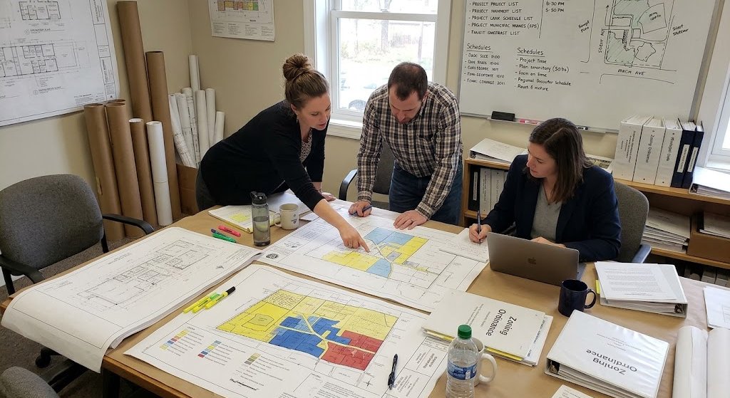

The Zoning Information and Map Access System (ZIMAS) is a powerful online tool developed by the Los Angeles City Planning Department. It helps property owners, developers, and consultants find detailed zoning and planning data for any parcel within Los Angeles city limits. Whether you’re planning a remodel, building an ADU, or researching a site for development, ZIMAS is your starting point.
Table of Contents
This guide will walk you through how to use ZIMAS, interpret its data, and apply it to your real estate or planning project. It also includes tips for avoiding common pitfalls and explains how professionals like JDJ Consulting use ZIMAS as part of broader zoning and permitting strategies.
Key Notes
- ZIMAS helps property owners check zoning regulations, parcel details, and land use information in Los Angeles.
- The platform provides access to overlays, planning restrictions, lot dimensions, and development data.
- Users can research property zoning in Los Angeles before starting construction or development projects.
- ZIMAS is commonly used for ADU planning, permit preparation, and feasibility analysis.
- The system includes parcel reports, zoning classifications, and neighborhood planning information.
- Understanding Los Angeles zoning codes through ZIMAS can help avoid costly planning mistakes.
- Property owners should review overlays and additional restrictions instead of relying only on base zoning.
- ZIMAS works best when combined with professional zoning consulting and permit research.
What Is ZIMAS and Why It Matters
ZIMAS (https://zimas.lacity.org/) is the City of Los Angeles’ official mapping platform. It provides detailed parcel-specific information about:
- Zoning and land use
- Historic and cultural status
- Building permits
- Fire zones and environmental overlays
- Transit, density bonuses, and incentives
ZIMAS aggregates data from Planning, LADBS, LAFD, and other city departments, making it a one-stop shop for:
- Confirming what can legally be built
- Checking for project restrictions
- Researching eligibility for housing density bonuses or ADUs
- Avoiding violations, delays, and redesigns
| Tool | What It Shows | Best For |
|---|---|---|
| ZIMAS | Zoning + parcel overlays | Property research |
| LADBS | Permits & inspections | Permit history |
| Assessor Portal | Ownership & tax data | Ownership research |
Expert Insights
Check More Than Base Zoning
Many Los Angeles properties include overlays, hillside restrictions, or special planning conditions that may impact development potential beyond the base zoning designation shown in ZIMAS.
Verify Parcel Information Early
Review parcel dimensions, frontage, lot size, and planning data before beginning architectural or construction planning to reduce delays during permitting.
Use ZIMAS for ADU Research
ZIMAS can help property owners identify zoning details and development limitations that may affect ADU feasibility in Los Angeles.
Cross-Check Planning Data
Zoning and planning requirements may change over time, so property research should always be verified with current Los Angeles planning regulations and permit requirements.
Step-by-Step: How to Use ZIMAS
1. Go to https://zimas.lacity.org
2. Enter Property Information
- Use the address, Assessor Parcel Number (APN), or cross streets
- Zoom in and click on the parcel
3. Navigate the Tabs
Each tab provides different types of data:
- Planning and Zoning: Zones, Height District, Community Plan Area
- Administrative: Council District, Neighborhood Council, Design Review Board
- Assessor: Parcel size, APN, Year built
- Jurisdictional: School District, Census Tract
- Recorded: Easements, Historic Resources
- Additional: Liquor License, Wireless Facilities
Watch complete tutorial here: How to Use ZIMAS by Official Website of City of Los Angeles
Key Sections to Focus On
Planning and Zoning Tab
- Zone Code: Tells you what land uses are allowed (R1, R2, C2, etc.)
- Height District: Limits on structure height and FAR (floor area ratio)
- Community Plan Area: Indicates broader planning goals
- Specific Plan Overlay: May impose additional restrictions
Additional Tab
- Transit Oriented Communities (TOC) eligibility
- Historic Preservation Overlay Zones (HPOZ)
- Very High Fire Hazard Severity Zones (VHFHSZ)
- Alquist-Priolo Fault Zones
These layers can affect construction methods, environmental review, and permit timelines.
What ZIMAS Can Help You Discover
Development Potential
- Can I build a duplex or fourplex?
- Can I add an ADU or SB9 unit?
- Is my property eligible for density bonuses?
Environmental and Safety Overlays
- Is the site in a hillside area?
- Does it lie in a fire or seismic zone?
- Are brush clearance rules required?
Permitting and Process
- Is the parcel under a Specific Plan or HPOZ?
- Does it require CEQA review or discretionary approval?
ZIMAS Use Cases for Property Owners and Professionals
| User Type | How ZIMAS Helps |
|---|---|
| Homeowners | Plan ADUs, room additions, and fire zone compliance |
| Developers | Pre-screen sites for zoning potential and TOC bonuses |
| Architects | Design to exact setback, height, and FAR limits |
| Investors | Evaluate opportunity zones, land use, and risk |
| Consultants | Provide full reports with maps and regulation breakdowns |
Common Pitfalls to Avoid
- Assuming zoning alone tells the whole story: Always check overlays, TOC, and special plans
- Using outdated data: Recheck ZIMAS before starting any new phase
- Overlooking CEQA triggers: Check environmental flags and LADBS requirements
- Misreading zoning labels: R1, R2, C1 zones vary by district
JDJ Consulting Relies on ZIMAS
JDJ Consulting uses ZIMAS as a baseline for all feasibility studies. Their team goes further by:
- Verifying on-the-ground site conditions
- Running entitlement and permitting pathways
- Preparing zoning summary reports
- Coordinating with Planning and LADBS staff for interpretations
For high-risk or complex zones (fire zones, slope band analysis areas, hillside ordinances), JDJ builds ZIMAS data into project timelines and compliance workflows.
Final Tips
- Cross-reference ZIMAS with LADBS Permit and Parcel viewers
- Use the export map tool for project documentation
- Always consult a zoning expert for projects over 500 sq ft or near overlays
Need Help Understanding ZIMAS and Zoning Laws
Getting the most from the ZIMAS zoning tool doesn’t need to be complicated. At JDJ Consulting Group, our expert zoning analysts, land-use consultants, and permit expeditors guide property owners, developers, and investors through detailed ZIMAS research, site feasibility assessments, and zoning strategy development.
Whether you’re evaluating a site, verifying zoning compliance, or preparing for entitlement approvals in Los Angeles, we’ve got your back.
- Visit us: 12925 Riverside Dr, Suite 302, Sherman Oaks, CA 91423
- Call us: (818) 793-5058
- Email: sales@jdj-consulting.com
Ready to streamline your zoning process?
Book your free consultation today or explore our full range of services, including zoning & entitlement, permit expediting, and land-use analysis.
Frequently Asked Questions About ZIMAS in Los Angeles
What does ZIMAS stand for?
ZIMAS stands for Zone Information and Map Access System. It is an online tool from Los Angeles City Planning that helps people check zoning rules, parcel details, overlays, and land use information for properties in Los Angeles.
How accurate is ZIMAS?
ZIMAS is usually accurate because it uses official city data. Still, some zoning updates, parcel changes, or planning overlays may take time to appear in the system. It is best to confirm important details with Los Angeles City Planning or LADBS before starting a project.
- Property lines may need a professional survey.
- Hillside rules and zoning variances should be checked separately.
- Planning determination letters can help confirm zoning details.
- ZIMAS should be used as a research tool, not a legal approval document.
How do I find zoning information in Los Angeles?
You can find zoning information by entering a property address into ZIMAS. The platform will show zoning codes, parcel details, overlays, and planning information connected to the property.
- Zoning codes explain what can be built on the property.
- Overlays may add extra rules or restrictions.
- Parcel reports include lot size and assessor information.
- ZIMAS is often used before planning construction projects.
Can ZIMAS show if I can build an ADU?
Yes, ZIMAS can help you check if a property may qualify for an ADU. It shows zoning information, hillside conditions, overlays, and fire hazard zones that may affect ADU construction in Los Angeles.
- Specific Plans and HPOZ areas may have extra rules.
- Transit areas may qualify for parking exemptions.
- Fire hazard zones can affect building requirements.
- Check both the Planning and Additional tabs for better results.
How do I read Los Angeles zoning codes?
Los Angeles zoning codes use letters and numbers to explain land use rules. These codes show if a property is residential, commercial, or industrial and explain building limits, setbacks, and density rules.
- Different zones have different development rules.
- Overlays may add more restrictions.
- ZIMAS helps users understand zoning information more clearly.
What is a parcel profile report?
A parcel profile report is a summary of property information from ZIMAS. It usually includes zoning data, lot size, assessor details, overlays, and planning information for a specific property.
- These reports help during property research and planning.
- Developers and consultants often use them before projects.
- Important property details should still be verified separately.
Does ZIMAS show overlays?
Yes, ZIMAS shows planning overlays and special property restrictions. These overlays may affect construction rules, environmental reviews, parking requirements, or land use limitations.
- Hillside overlays may limit grading or building height.
- Historic districts may affect exterior changes.
- Transit overlays may change parking rules.
- Environmental overlays may require extra approvals.
How do I check hillside restrictions in Los Angeles?
You can check hillside restrictions by searching the property in ZIMAS. The platform shows overlays and planning layers that may affect grading, retaining walls, setbacks, and building height limits.
- Some hillside projects need geotechnical studies.
- Steep lots may have stricter building rules.
- Restrictions can vary by area and property conditions.
Is ZIMAS free to use?
Yes, ZIMAS is free for public use. Anyone can access the platform on desktop or mobile devices without creating an account.
- ZIMAS does not show complete permit history records.
- Permit applications must still go through city departments.
- Some projects may still need professional zoning help.
Can ZIMAS help with permits?
ZIMAS can help users prepare for the permit process. It provides zoning and planning information that helps property owners understand restrictions before submitting permit applications.
- Permit approvals are handled by LADBS and other agencies.
- Zoning information should be verified before construction begins.
- ZIMAS is commonly used during early project planning.
Can I use ZIMAS for commercial development?
Yes, ZIMAS can be used for commercial and mixed-use property research. Developers often use it to review zoning rules, overlays, and planning conditions before starting commercial projects.
- Commercial zones may have extra development rules.
- Specific Plans can affect project design requirements.
- Environmental overlays may require additional reviews.
Does ZIMAS replace a zoning consultant?
No, ZIMAS does not replace professional zoning consultants. The platform helps with research, but larger or more complex projects may still require expert help for permits, entitlements, variances, and planning approvals.
- ZIMAS provides information but not project strategy.
- Consultants help interpret city planning rules.
- Professional guidance can help avoid delays and mistakes.
What if my parcel shows conflicting data?
Conflicting parcel data can happen when zoning boundaries or overlays overlap. If the information seems unclear, property owners should verify the details with Los Angeles City Planning or request professional zoning analysis.
- Official zoning maps may help confirm property information.
- City planners can explain overlay conflicts.
- Professional reports may help clarify development questions.
Can ZIMAS help with SB 9 lot splits or duplex projects?
Yes, ZIMAS can help users review zoning and overlays related to SB 9 projects. It helps property owners understand parcel conditions and development restrictions before planning lot splits or duplex construction.
- Lot size and frontage should still be verified separately.
- Infrastructure conditions may affect feasibility.
- Building and Safety review may still be required.
Can I download or print my ZIMAS findings?
Yes, ZIMAS allows users to print parcel maps and export reports. These documents are useful during planning, feasibility studies, permit preparation, and consultant meetings.
- Reports help organize zoning information.
- Parcel maps support project planning discussions.
- Professional zoning reports may include deeper analysis.
What does R1 zoning mean in Los Angeles?
R1 zoning usually means single-family residential zoning. These properties are mainly intended for detached single-family homes, although overlays and additional planning rules may still affect development options.
- Height and setback limits may apply.
- ADUs may still be allowed on some properties.
- Overlay districts can add extra restrictions.